Lee to Compton Abbas
After spending many a lesson in the circuit at Lee taking-off and landing, it was finally time to leave the circuit and do some actual flying. After the circuit comes navigation. There is lots to learn and put into practice.
As I’ve mentioned before my Dad is also learning to fly. But he is about 10 hours ahead of me! He had already done an away trip trip with some navigation. Our jaunt to Compton Abbas would be my first real navigation trip and his second.
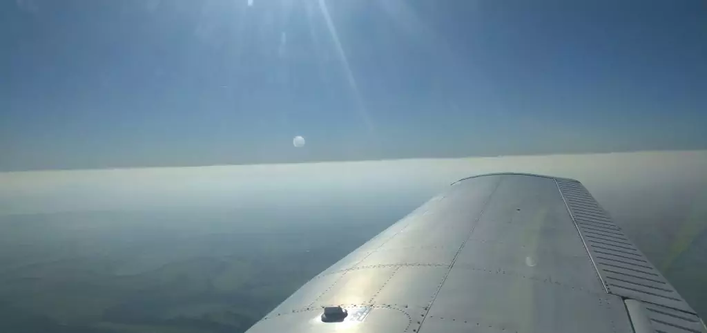
We would be flying out to Compton Abbas in Dorset. Compton Abbas sits at 811ft in amongst rolling hills and green fields. I had been there once with my parents as a child so I was pretty excited about visiting again. My Dad would be flying the outward leg and I would fly the return leg after we had a cup of tea. The outward leg was going to be a bit more complicated than mine. It required some flight planning. We calculated our speed, heading and altitudes and did some manual work involving our flight computers. The weather was excellent except for the haze on the horizon. This was caused by a temperature inversion. This is where the air gets warmer the higher you get; rather than colder. It makes for a spectacular view: decreased visibility and the illusion of a storm building on the horizon and below us.
After a planning session we headed out the the ever trusty Piper “Hotel Alpha” and fired her up. My Dad taxied out to runway 05 and off we went.
The first stop on our journey was at Cowes from there we pointed ourselves in the direction of Wareham, a small town to the west of Poole. I didn’t have much else to do in the back other than observe and enjoy the views.
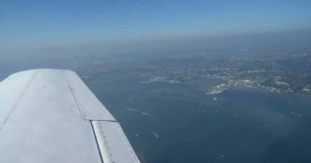
We cruised past the Needles on the Isle of Wight and past the piers at Bournemouth and over Poole harbour.
 <figcaption class="caption wp-caption-text">Poole Harbour below the wing</figcaption></figure>
We obtained clearance from Bournemouth just incase we encroached on their airspace. This was my first time hearing interactions with traffic controllers dealing with airspace like Bournemouth – I am going to need to increase my confidence on the radio!
Wareham is very distinctive as it is a town split by a river. It would be easy to mistake it as two separate towns. As we overflew we changed our heading to North and in the direction of Compton Abbas. In our previous leg we had the coast below us and a lot of great land marks to help us work out where we were. There wasn’t much of that on this leg. There were a number of small villages and roads but that was about it.
 <figcaption class="caption wp-caption-text">Haze on the horizon</figcaption></figure>
After we had been flying for the set time our instructor asked us if we could find the airfield – we couldn’t.
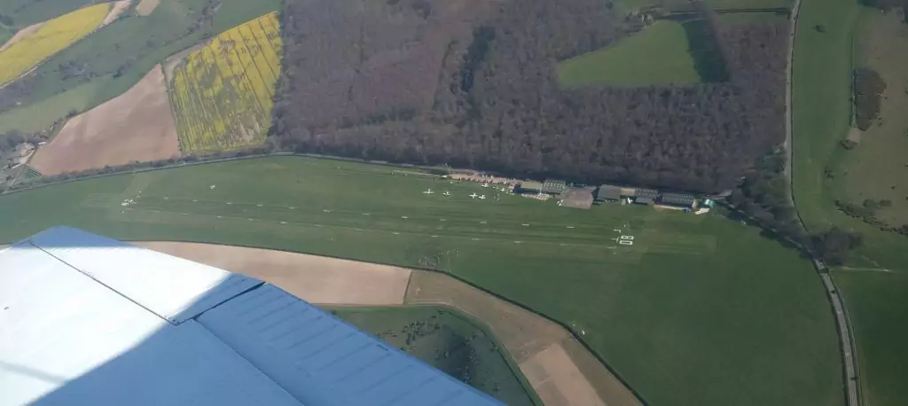
By luck I looked forward and starboard and out of nowhere it materialised directly below us; a green runway flanked with white markers and a row of small planes. On the very edge of the airfield there was a small forest that seemed to keep it well hidden to those pilots who didn’t know what they were looking for.
 <figcaption class="caption wp-caption-text">Compton Abbas below with a small forest above</figcaption></figure>
My Dad flew an overhead join and flew the circuit and made a smooth, well as smooth as it can be on grass, landing. We parked up and headed over to the cafe and seating area.
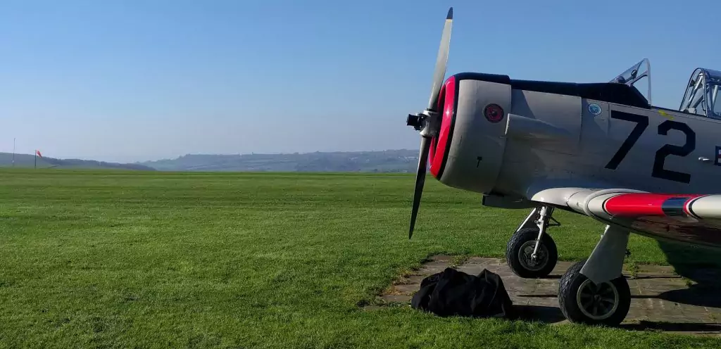
There was a variety of general aviation aircraft at the airfield. My favourite being a mighty Harvard painted up in a US Marines livery and kept in pristine condition.
 <figcaption class="caption wp-caption-text">A Harvard in a US Marines in livery with the runway and hills in the background</figcaption></figure>
After a cup of tea, a short debrief for my Dad and a briefing for me it was time to head back home. I started up the plane and taxied to the runway.
It was my first grass runway take-off and it was memorable to say the least. The runway was bumpy and sent me bouncing up and down before I actually got airborne.
We climbed and turned to the west heading into the hazy horizon. We made a practice emergency location request using 121.5 and then I was tasked with getting part of the way home using just a heading a landmarks I should expect to find.
My first landmark was looking for the River Avon; I was vary naive and for some reason was looking for a big blue streak across the fields below. I should have known different as I’ve been living in these parts for a while now. Eventually I spotted the what I would describe as the stream Avon and was able to work out where I was without a problem.
The next landmarks were the old disused aerodromes at Stoney Cross and Beaulieu. Whilst they are old and overgrown their runways are distinctive and easy to spot. They will be helpful landmarks I will be using in my future.
Once I crossed the coast I pointed us towards Cowes on the Isle of Wight for the end of our round trip. At this time of the day the sun was beginning to set and the Solent looked simply beautiful; sea fog rolling in and a cloudless sky above us.
I flew the approach and landed without any dramas. We taxied back to the apron and shut down.
It was very exciting flying further west than I had been before, seeing new lands and views that I hadn’t seen before. I can’t wait for next time.
Below is the route we flew, Red is my Dad and Blue is me.
 <figcaption class="caption wp-caption-text">The route we flew. Red was my Dad and Blue was me.</figcaption></figure>